|
|
|
ENGINE REPOWER PROJECTS
Follow us on:
|
River Trip to Parker Marine, Inc.
Your
trip to Parker Marine, Inc. will begin at the Harbor of Lorain in the City of
Lorain, Ohio. The Port is located between the cities of Cleveland and
Sandusky on the south shores of Lake Erie. As you enter the harbor, you
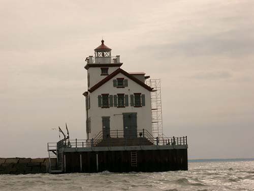
will see the Lorain Lighthouse, a well-known Lorain landmark
(coordinates are N
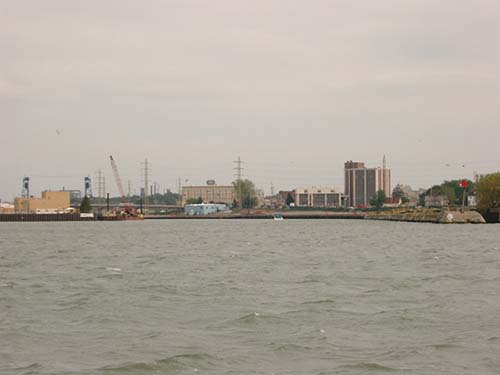
41 28.649 degrees / W 082 11.431 degrees), which is presently being renovated. As you enter the Harbor of Lorain, you will notice things such as the Ohio Edison electrical plant (the stack can be seen for miles from out in the lake) to the right, the Spitzer Lakeside Marina, to the left, the Lorain Water Treatment plant on the river and a glimpse of Lorain City Hall (the tall building in the picture to the right).
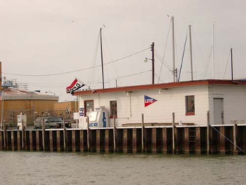
Next to the Lorain Water Treatment plant is the Lorain Sailing and Yacht Club. At the LSYC gas dock you can top off your fuel tank (gasoline only). Bobby Rhodes, manager, can be reached at 440-288-0500. Around the corner is Spitzer Lakeside Marina gas dock that does sell diesel fuel and has a pump-out station.
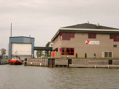
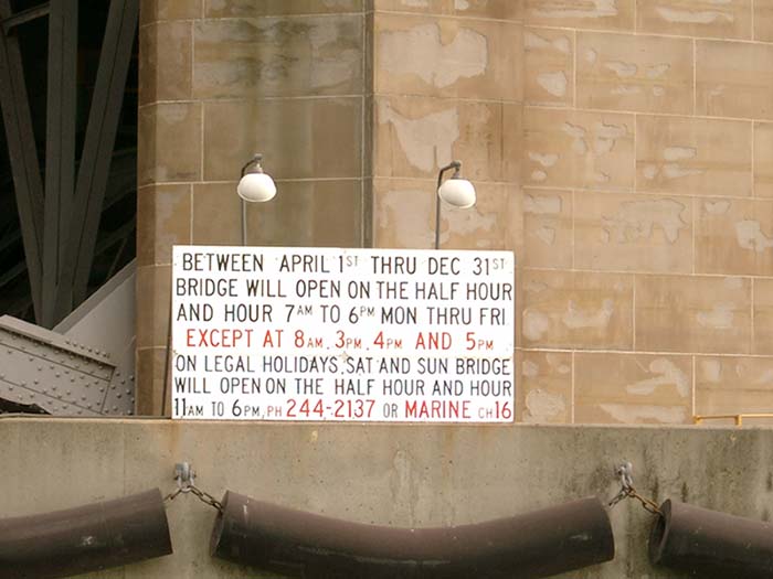
After you pass the LSYC gas dock, you will come upon the Lorain Coast Guard station. Be aware of your speed since once you enter the harbor, you are in a no-wake zone. Directly ahead of you will be the first bridge, the Charles Berry Bridge. There are certain times during the day in which this bridge will raise for river traffic. Notice the sign below for times and a telephone number to speak with a bridge personnel. Write down the phone number and keep it with you on your boat. If you don't have a cell phone, one long horn followed by two shorts will alert these bridges of your need to pass.
A picture of the bridge sign with days, times and a telephone number for your information. Just on the other side of the Charles Berry Bridge is Spitzer Riverside to the left and the river to the right.
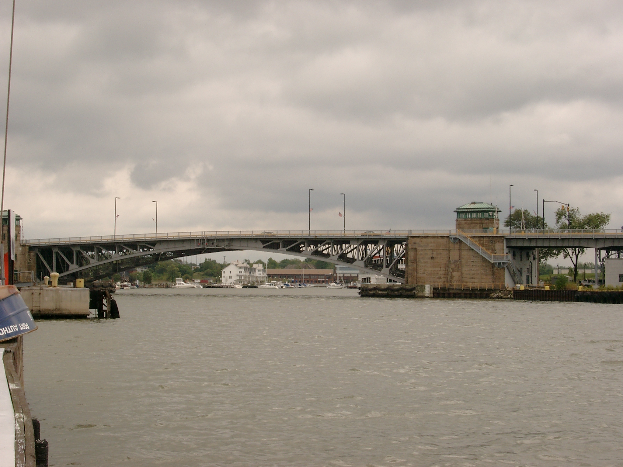
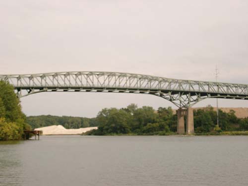
At this vantage point you can plainly view the second bridge in the photo at the right. This is the Norfolk-Western railroad bridge. Sailors Beware! You will NOT make it under the NW bridge with your mast up! They can be reached by telephone at 440-244-4248 or via your VHF.
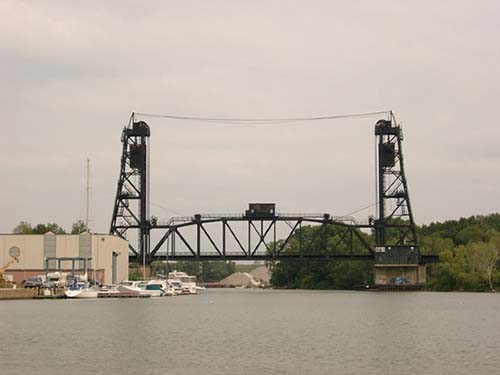
The Black River turns and bends and narrows as you travel toward Parker Marine, Inc. The bridge pictured to the left is known as the Henderson Bridge. This bridge has a clearance of 120 feet. This is the last bridge you will travel under. To the right is the Lorain Public launch ramp. This public launch ramp is located just off Broadway and 14th Street.
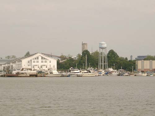
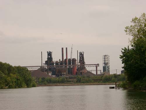
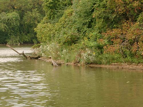
This part of the steel plant will be your last visible landmark. This area is where the ore ships load and unload and turn around to head back out to Lake Erie, or also known as the Turning Basin. The river here is about 20+ feet and you will notice a change in depth to about twelve feet once you round the bend. The river will maintain a depth of 7 to 12 feet in the middle from this point on, with the exception of the area around the island. If you are a nature-lover, you will want to pay close attention to your surroundings once you leave the Turning Basin area. You will see wildlife such as American Bald Eagles, Blue Heron and Kingfishers nesting or in flight. In the water will be beaver, muskrat and snapping turtles with an occasional water snake afloat.
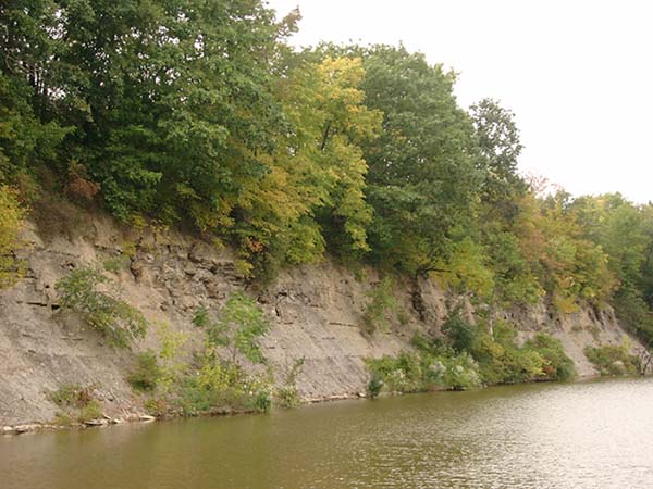
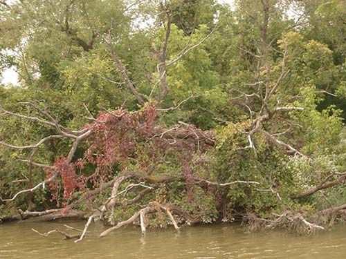
Scenic shale along River Blue Heron fishing Black River plant life About now you are
wondering where we are taking you. This is the part of the trip where you
will want to watch for debris in the river, to stay close to the center where it
is the deepest, and to stay in the channel on the west side of Turtle Island (a
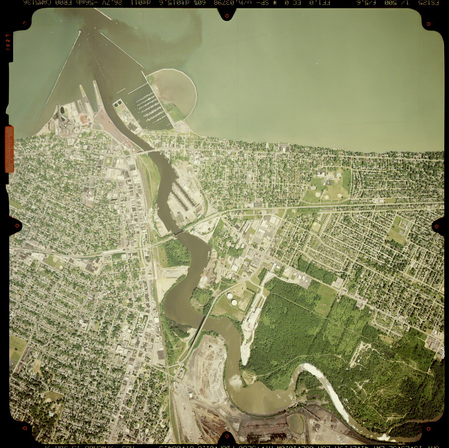
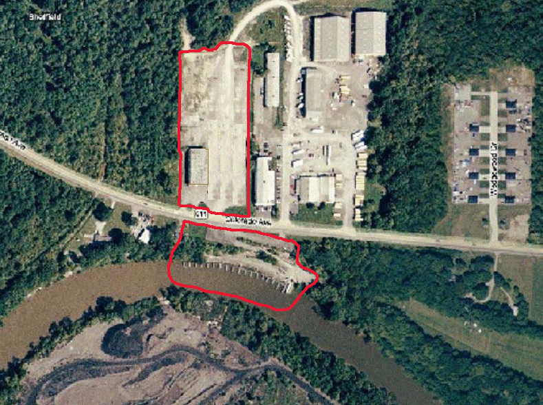
small island just before our marina). This satellite photo shows just how
long the Black River is and Parker Marine, Inc. is almost at the end of it.
At the bottom right-hand corner you can see where the river channel splits, this is where the island is located. Also take note of the location of the three bridges and the Turning Basin and how the river narrows at the south end. The photograph does not include our marina but it is just off the picture.
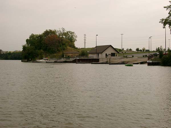
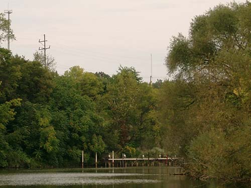
The river maintains a depth of about 7 feet on the average; deeper in some areas. Soon you will come upon an electrical pole rising above the treetops and then signs of a marina.
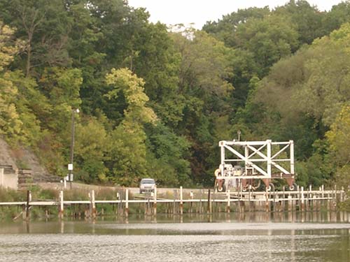
You have made it to Parker Marine, Inc. for your repair and storage needs. Set your "Way Point" for N 41 27.705 degrees/W 082 07.374 degrees (we do not recommend that you use your Auto Pilot).
You can choose a dock that is open and easy for you to dock at. We ask that you don't choose the travel-lift well for obvious reasons.
If you arrive for repair, simply give us a call to let us know of your arrival. If you are here for storage, we have a “Sign-In” box located in the parking area which you can put down your name and what dock you are in. We hope this information has been informative to you and that it answered your questions. Have a safe trip.
Birdseye view of Parker Marine, Inc. facility and marina:
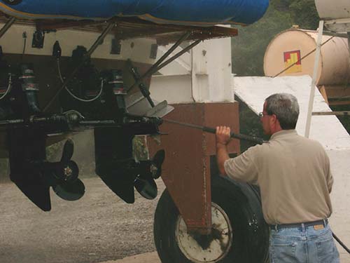
Even the Boss has to wash boat bottoms
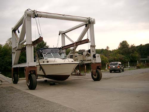
A boat in PMI travel lift
|
|
[Home] Send email to dick@parkermarineinc.com with questions or comments about this website. Last modified: August 22, 2014
|